Sunday, 20 September 2026

FAO to Sign Contract with Iran’s Agriculture Ministry

FAO to Sign Contract with Iran’s Agriculture Ministry
 

Food and Agriculture Organization of the United Nations known as FAO is going to sign an agreement with the Islamic Republic of Iran to boost agricultural productivity of the country using a satellite imagery tool


The United Nations Food and Agriculture Organization (FAO) will sign on Wednesday a Memorandum of Understanding on cooperation with Iran’s Ministry of Agriculture, as part of a project to upgrade the tool for monitoring agricultural production using satellite imagery, and promote the monitoring of agricultural products remotely.

According to a Farsi report by Tasnim News Agency, the program uses a pixel-based methodology to produce comprehensive maps allowing for better use of natural resources. When coupled with real-time data, agricultural extension agents can help farmers obtain more reliable crop yields, both improving their livelihoods and making them more sustainable.

The tool can produce detailed assessments to monitor the functioning of a selected set of irrigation schemes, supporting modernization plans as well as helping assure that improvements do in fact result in all water users receiving more reliable and cost-effective water services that are more adapted to increased climate variability.

Iran Taking Tourists on Tours of

Saffron Harvest


Iran’s South Khorasan province annually hosts numerous foreign tourists during the season when saffron and barberry are harvested

Foreign tourists visit the eastern Iranian province of South Korasan each year as the season to harvest saffron and barberry begins, and this year is no exception

“This year, too, foreign tourists have begun visiting the province as the harvest season for saffron and barberry begins,” said Morteza Arabi, the deputy head of the provincial Cultural Heritage, Handicrafts and Tourism Department

According to a Farsi report by Miras-e Arya news agency, he said the department has helped organize tours of tourist attractions and historical monuments in the province for foreign guests

During the tour, he said, tourists will visit several places, including an anthropology museum, an ancient public bath, a historical school, old neighbourhoods, old houses, paddy fields, an ancient garden, a warm water spa and a historical fortress

The tourists will also take a tour of saffron farms, he said


Fifteen European Banks to Transfer Money to Iranian Merchants


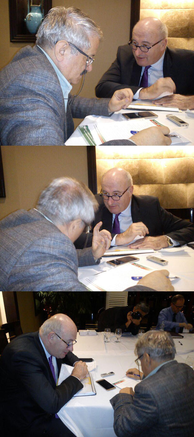
The exclusive conversation of Mansour Ansari, director and editorial secretary of the magazine "Agricultural Industries Industry" and "Advance to Agricultural Economics", by Phil Hogan, the EU's High Commissioner for Agriculture, headed by 70 members of the agricultural and food industry and merchants And businessmen

.from different European countries live in Tehran


In this exclusive interview at Spinase Hotel and Phil Hogan's Special Pavilion today, the issue of reducing tariffs on exports of Iranian agricultural products to the European Union, the transfer of money and the opening of Swift banks in Europe, the signing of contracts and commercial agreements with the public sector and private sector of Iran , The results and achievements of this trip, We also continue to cooperate in the field of agricultural economics under the conditions of official and unofficial American pressure, joint EU investment with private sector activists of our country, re-export and joint production licensed by European countries, including chicken meat, and the use of export capacities of European countries to penetrate. The markets of the countries of the region were discussed and discussed the full text of this conversation will be released shortly in the "Green News Agency of Iran" at www.agriwe.news or www.sabznn.ir and two of the aforementioned magazines.


Sunday 2017/11/12


Iran Invited to Manufacture Agricultural

Machinery in Uganda


Uganda’s Foreign Minister Sam Kutesa has called on Iranian manufacturers to produce agricultural machinery in the African state and export their products from there

In a Wednesday meeting with Iran’s Foreign Minister Mohammad Javad Zarif in Kampala, Kutesa said Uganda tries to prepare the grounds for increased presence of Iranian firms in the African state

“Iranian companies will be able to operate in Uganda in various fields including the production, assembly, and export of agricultural machinery,” he noted

The Ugandan FM also highlighted the continuation of his country’s positive cooperation with the Islamic Republic of Iran in international bodies

Zarif, for his part, called for further expansion of bilateral relations and mutual cooperation between the two sides at different levels

He also referred to the high-ranking delegation accompanying him in his visit to Kampala, and expressed the hope that Iran and Uganda would start their mutual economic cooperation as soon as possible

Zarif and Kutesa also discussed latest regional and international developments

?How much water flows into agricultural irrigation

Findings will lead to better agriculture choices and water management decisions

This aerial photo was taken east of Denver, Colorado, above a region dense with irrigation systems.
Credit: David Hyndman


Irrigation for agriculture is the largest use of fresh water around the globe, but precise records and maps of when and where water is applied by farmers are difficult to locate. Now a team of researchers has discovered how to track water used in agriculture.

In a paper published in the journal Geophysical Research Letters, the researchers detail their use of satellite images to produce annual maps of irrigation. The findings, the scientists said, will help farmers, water resource managers and others understand agricultural irrigation choices and make better water management decisions.

"We want to know how human activities are having an impact on the environment," said hydrogeologist David Hyndman of Michigan State University (MSU), principal investigator of the project. "Irrigation nearly doubles crop yields and increases farmer incomes, but unsustainable water use for irrigation is resulting in depletion of groundwater aquifers around the world. The question is: 'How can we best use water?'"

The paper highlights the need to know when and where irrigation is occurring to effectively manage water resources.

The project focuses on an economically important agricultural region of the central U.S. -- the Republican River Basin -- that overlies portions of Colorado, Nebraska and Kansas, and provides surface water and groundwater to the High Plains Aquifer. The team found that irrigation in this area roughly doubled between 2002 and 2016.

Water use in this region can be complicated because it is regulated to preserve stream flow into Kansas in accordance with the Republican River Compact of 1942.

"Previously, we knew what farms were equipped to irrigate, but not which fields were actually irrigated in any particular year," said Jillian Deines, also of MSU and the paper's lead author. "Our irrigation maps provide this information over 18 years and can be used to understand the factors that contribute to irrigation decisions."

The researchers used Google Earth Engine, a cloud-computing platform that makes large-scale satellite and environmental data analyses available to the public, to quantify changes in irrigation from year to year -- an important finding for farmers, crop consultants and policymakers working to improve the efficiency of irrigation.

Google Earth Engine has been an asset for computing the large number of satellite images needed, the scientists said. "It allows researchers to use consistent methods to examine large regions through time," Deines said.

The project, which also involves MSU research associate Anthony Kendall, is supported by the joint National Science Foundation (NSF)-USDA National Institute of Food and Agriculture (NIFA) Water, Sustainability and Climate (WSC) program and the joint NSF-NIFA Innovations at the Nexus of Food, Energy and Water Systems (INFEWS) program.

"Knowing what to plant, how much land to plant, and how much irrigation water is necessary to support a crop through harvest has been a challenge for farmers throughout time," said Tom Torgersen, NSF program officer for WSC and INFEWS. "Farmers can now envision a future where models will provide options to help guide decisions for greater efficiency and crop productivity."

Program managers at USDA-NIFA said that demand for agricultural products will likely increase in the future, while water for irrigation may decrease due to water quality issues and competitive uses.

The Republican River Basin researchers "leveraged new computing power to handle the 'Big Data' of all available Landsat satellite scenes, and developed irrigation maps that help explain human decisions about irrigation water use," said Jim Dobrowolski, program officer in NIFA's Division of Environmental Systems. The maps hold the promise, he said, of the ability to make future water use predictions.

A NASA graduate fellowship program award also funded the research.

Story Source:

Materials provided by National Science FoundationNote: Content may be edited for style and length.


All intellectual property rights are reserved.